Denver’s Coldest Start To A Year Since 1979
Much of the U.S. has held extremely cold so far in 2023, and the Front Range has been no different.
As of Tuesday, this is Denver’s coldest start to a calendar year since 1979, according to data from both Denver International Airport and the city’s Central Park weather observation site.
With an average temperature of 30.3F at DIA and 30.6F in Central Park, Denver is holding a whopping 7F below the long-term year-to-date average.
The big freeze isn’t just confined to Denver, of course — the entire Western U.S. has endured a historically cold and snowy first quarter of 2023, with snowpack across Colorado, Utah, Nevada and California, for example, surpassing all-time records.
The MSM is struggling with these facts, and is has been on damage control for months.
“This is It’s important to note that despite this cold and snowy winter in Denver and Colorado, climate change is still making Colorado warmer,” goes a recent explain-away, copied-and-pasted across a number of legacy media outlets. “Even in an overall warming climate, there can still be colder and snowier winters, and the start of 2023 is a clear example of this.”

Like Americans, many Canadians are also waiting on spring to sprung, particularly Manitobans.
Natalie Hassell, warning preparedness meteorologist with Environment Canada, said weather in March has been unusual.
“We don’t keep stats for the length of time where a temperature hasn’t reached a particular threshold, but we have the number of days we typically see,” said Manitoba based Hassell.
“In Winnipeg in March,” she continues, “using the 1989 to 2010 Canadian climate normals, March has about half the month reaching temperatures above zero. The fact we haven’t had any in Winnipeg this year is remarkable.”
Hassell said the last time a March in Winnipeg did not see a temperature above 0C (32F) was in 1899.
“We’re still going to stay below normal even well into April,” concluded Hassell. “It will probably be until the middle of April at the earliest before we see actual normal conditions in Winnipeg”–but as we’ve been reliably informed, even in an overall warming climate, there can still be colder and snowier winters, and springs, and summers, and falls…
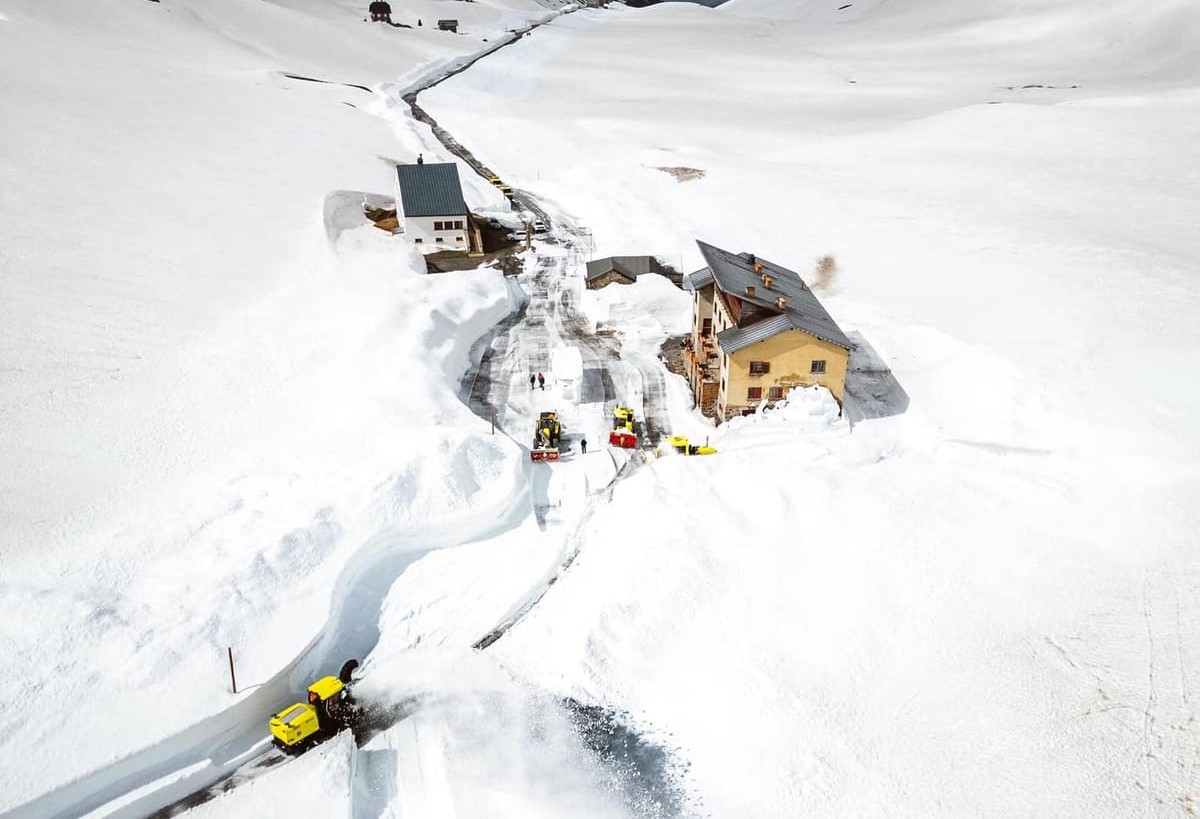
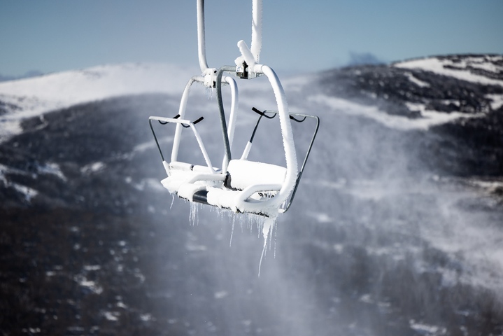
There Will Be Skiing On 4th Of July
California
Tuesday’s snowstorm extended California’s statewide snowpack to new record highs, and also prompted yet another round of avalanche and winter storm warnings.
This week, Cali snowpack is 227% of the April 1 average. “That is higher than any other reading since the snow sensor network was established in the mid-1980s,” said Sean de Guzman, manager of DWR’s Snow Surveys and Water Supply Forecasting Unit.
More snow is on the way, too — another 2+ feet in some isolated spots.
“A powerful storm with gale force winds and high intensity snowfall will lead to widespread avalanche activity in the mountain,” the NWS said, adding, “Large avalanches could occur in a variety of areas.”
The calendar may read spring, but Caltrans warns, “Winter isn’t over yet! Be prepared for difficult driving conditions.”
Such conditions make are making summer skiing a distinct possibility. Palisades Tahoe has extended its season through July 4; Mammoth Mountain is staying open until July 30; and elsewhere, Snowbird, Utah will close May 27, with similar closing dates posted at Mount Bachelor, Oregon and also Whistler-Blackcomb, B.C., Canada — this isn’t a localized phenomena.
Nevada
Record seasonal snowfall has hit Lee Canyon Resort, Nevada, too.
Resort Market Director Jim Seely confirms that 256 inches has accumulated so far, which surpasses the previous record (255 inches from 2005). And with another 10 inches forecast by Wednesday night, this season is set to continue rewriting the books.
As with the resorts above, Lee Canyon’s ski season has been extended, to April 9.
Seely is also not ruling out a further extension.
Utah
On March 25, Alta Ski Area announced that this season is their snowiest ever, with yet more snow on the way.
Alta has racked up 764 inches since the first flake fell back on Oct 22.
That’s an average of almost 5 inches per day.
Looking ahead, OpenSnow is forecasting another 23 inches over the next 5 days and an additional 28 inches in the 5-10 days.
Alta is well on its way to eclipsing 800 inches, with estimates pegging this season, by the close, at over 850 inches (71 feet!).
Elsewhere in Utah, on Monday, Snowbasin also broke its all-time snowfall record of 475 inches set during the winter of 1981-82.
Then on Tuesday, following another powerful storm, the resort extended the record further, surpassed 500 inches.

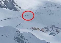
On Mount Timpanogos, located outside the Sundance Resort, Utah, a large avalanche was captured on video.
The video, shot by Thomas Farley shows the a large powder cloud careening down the hillside.
“(Monday), there was a natural avalanche that started on Mount Timpanogos and carried down the mountain into an area outside of our ski area boundaries,” Sundance Resort said on Twitter. “Footage shows the dust/wind cloud reaching guests who were watching, but no one was hurt as (the) deposition area never reached our boundaries.”
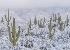
“Once In A Generation Snow” Hits North America’s Hottest Desert
Adding to the historic snowpacks listed above, Arizona, too, has been posting impressive totals.
Flagstaff, for example, has logged 11 feet so far this season — its greatest accumulation in more than 70 years.
And one I missed from earlier in the month:
Swathes of the Sonoran Desert–which spans 100,000 square miles across Mexico’s Sonora, Baja California, and Baja California Sur, and America’s Arizona and California–saw an incredibly rare 4 inches of snow back in early March.
Landscape photographer Jack Dykinga, who has been shooting the Sonoran Desert since 1976, said that snow hadn’t fallen in the area in a decade, adding that the scenes were “pure magic, seemingly out of place and strikingly beautiful”.

Bianca Feldkircher, a NWS meteorologist, said La Niña and a persistent blocking pattern over the Pacific drove fiercely cold Arctic air unusually-far south, which created the ideal conditions for the rare dessert snow.
Feldkircher said of this winter’s remarkable pack in general, “Not only were you getting significant snowfall in areas that already see snow, you were also seeing snowfall on lower elevations, which is super rare.”
Ipso facto, this isn’t ‘warm snow’ that’s falling confined only to the highest mountain tops, as The Narrative would have us believe; rather, the snowline is descending deep down into the valley floors, to the lower elevations — you need COOLING for this to occur.
“This snow is highly unexpected,” said mainstream meteorologist and former NOAA chief scientist, Ryan Maue.
“It’s like once-in-a-generation.”

“This snow is highly unexpected,” said mainstream meteorologist and former NOAA chief scientist, Ryan Maue.
“It’s like once-in-a-generation.”
That’s once-in-a-generation for the outgoing generation.
It will be normal for the incoming generation!
Meanwhile in SW Florida for March pre-dawn temps bumped into the low 70s on the 5th, 14th & 25th. Interesting they showed a decreasing trend – 74 F, 72F, 70 F.
From the 16th thru 24th it stayed in the 50’s, bumped to 70 then has been in the 60’s the last 4 days.
My benchmark here is when the night temp hits 72 and stays there until the Sept/Oct. I remember that happening in the middle of May (been here 20 years).
Just checked my records, the last time this happened was in 2018 on May 13th.
It is now staying “cool” until the middle of June, last year until 29th June. Seems the climate change is definitely to the cold side!!!
Dallas Schneider
Environment Canada reports, “Another cold morning in Saskatchewan has led to 3 consecutive days of broken records.” next door to Manitoba. Cold temps in the -20s and -30s C: https://weather.gc.ca/warnings/weathersummaries_e.html#ON
We are now having our 16th rain this year in the Bakersfield area. I live in Poso Flat a small cattle / horse community 30 miles from Bakersfield, Ca. In the southern Sierras. Elevation 2,440 feet. The local news weathermen have continued to state that Bakersfield temps are at least 10 degrees below normal all winter. Yet in the shallow media news & weather the only person to answer my winter question has been Cap. What has caused this extreme world wide cold weather so quickly. I knew it was not just lack of sunspot activity. Cap is the only one to point out our extreme weather is from the the eruption of the Hungarian Tonga volcano by posting an article from a Volcano expert. I researched all over google after reading this article. Every report said the eruption will cause global warming. How wrong the green extremist are. I very much am opposed to the green scam that is taking place. I am so disappointed in a humanity that does not bother to research what is taking place. We are absolutely in a slow moving extinction event on this planet.
Hunga Tonga Ha’api eruption January 2022 is the cause of this cold
Ehh I like the ‘Hungarian’ version better tho!😂😂😂
Add the Suns output has lessened possible MORE than we know, add volcanic dust way up yonder and you get…COLD SNOW not ‘hot snow’…whatever the hell that is!!!
I am wondering if the La Nina triple is over OR may we be getting another…and another…and then we will ALL find out how cold HELL🥶 really is!!!😁😂
South Central KY and we have been soaked this winter, only 2″ snow this Winter and frost this morning (3/2932023). And ZERO crops planted…ground to cold.
The Hunga Tonga–Hunga Haʻapai volcano is a part of the Tonga-Kermedic Ridge subduction zone that continues South to join White Island and the Taupo caldera.
http://swpacificplates.weebly.com/uploads/2/5/8/3/25836264/1391124649.jpg
There has been recent semi continuous seismic activity in the Bay of Plenty, NZ, between White Island and Taupo.
You can go back and find the solar flare that popped Tonga and where the planets were that made the flare jump. I was watching the Global D layer site that night waiting for the CME to hit and BOOOOOM!! I was also watching SO2 on Windy and off went Tonga. I posted the whole thing here when it was happening along with many many other similar events.
The key planets are in a similar position right now and there was an X flare last night also Tonga quakes again. Same ol same ol.
You can backtrack to find the flare and the Global D hit that popped Tonga on:
https://www.youtube.com/c/DailyEventsWorldwide/videos
My internet was down for an hour last night during the Global D blackout from 1:30 to 2:30 from the X flare:
https://www.solarham.net/pictures/2023/mar29_2023_x1.2.jpg
My Simsolar app went out last night too during the chaos and it still has an error code.:(
https://www.pwr-tools.com/simsolar/index.htm
The bigger alignment is during three weeks, more flares more volcanos. Many other volcanos are contributing to the record snow EVERY DAY !!!! I’ve been on here two years doing play by plays and a year and a half on IAN before that, same revolving door,,,spinning spinning spinning.. I used to go on Tallblokes Talkshop ten years ago telling them to watch the alignments and flares and volcanos and cyclones all they talk about is Climate Change crap and I gave up on them after Hurricane Sandy. Punks. https://tallbloke.wordpress.com/
Ben Davidson used to cover it all eight years ago with Kongpop Uyen from NASA but got too distracted everyday coming up with new new new stuff everyday, went OCD on the flip for two years. Uhg. I will go watch the Electroverse now in all it’s glory with the best of my limited abilities and try my best not to be a pest. Enjoy. https://soho.nascom.nasa.gov/data/LATEST/current_c2.gif
Should say– next three weeks. During the next three weeks, big alignments, more solar flares, more volcanos, more cyclones with warm fronts and cold fronts. Same as it ever was…
Talking heads.
Mr. Pitt, What is aligning is why is it bigger than the conjunction that just occurred between Venus + Jupiter a few weeks ago?
On a side note: I am grateful for those who have knowledge to share, enabling additional research to grasp Truth.
Mr. Allon, Thanks.
Hi Dirk. Thank you for the references , again.
I will research over the weekend and rationalize to minimalize dumb questions.
I am not a subatomic particle physicist so the mechanism of solar wind agitating volcanic eruptions is still beyond me.
I think of tornados as electric motors. It looks like the tornado cloud comes down to feast on the earth because it is feasting on the earth, seeking electrostatic equilibrium the same as lightning.
So with 80percent of solar wind being positive charge I still have not figured the mechanism of some bigger storms. Any references to credible hippopothesis would be welcome. (an African, water dwelling scientific theory)
Thank you for being patient
I used to live in Colorado. We went snowboarding in the summer quite frequently, and I can remember 4th of July snowboarding down Loveland Pass. Mid 1990’s. Burgers, grills, kegs of beer, and snow. Fun times.
Heads up,
there is a coronal hole on our side of the Sun at fairly low latitudes – mainstream experts say not as strong as the last one but with our weakened magnetosphere could be very interesting….
March 20th 2000 Dr David Viner, a senior research scientist at the climatic research unit (CRU) of the University of East Anglia said that snowfalls are ‘now just a thing of the past’, children won’t know what snow is.
March 20th 2022 Alta Utah “hold my beer while I collect record amounts of snow”
The Viner quote is listed in https://extinctionclock.org/ which lists climate scientists’ doomsday claims and whether they have come true or not. Start at the bottom and work up, so far 49 claims have reached their due-by date and not even one has been correct, the 50th failure will be in 19 days time.
The Arctic was supposed to be ice free by the year 2000 – that is three years before Greta Thunberg was born, so they have been wrong for her entire life, yet she still believes them! Why?
Another big solar wind going to hit on Friday,,,,31 march, eyes wide open.
That https://extinctionclock.org/ ought to be plastered all over social media, and maybe someone with deep pockets get it advertised on websites or remaining newspapers, etc.,… It’s maddening listening to looney leftists, and trying to reason with most of them on the subject. Then again, from personal experience, those leftists are so dense I don’t think any amount of reasoning will penetrate their closed minds.
Mt Hood Oregon is open all summer for skiing, the upper chair doesn’t open until late spring. All other areas could stay open much longer than they do but they only pay insurance until a given date and they don’t have enough customers make a profit because people have too many other interests in the spring. Doesn’t pencil.
They don’t have a problem with no snow from runaway global warming and that is a fact. My wall clock broke and it’s right twice a day compared to Al fricking Gore who is NEVER RIGHT. And our Climate Czar John fricking Kerry is stuck on one eighty out backasswards. And JB? OMFG. WTF is WRONG with goofy fookers?
https://www.timberlinelodge.com/conditions
Ski at Crystal Mt into summer too: https://www.crystalmountainresort.com/the-mountain/mountain-report-and-webcams/webcams
https://www.zerohedge.com/political/john-kerry-says-new-climate-change-executive-orders-are-coming
.