Winter 2023-24 is approaching, and a new Polar Vortex is strengthening in the Stratosphere over the North Pole.
In recent years, the phrase ‘Polar Vortex’ has been adopted by the climate cabal to mean descending Arctic air masses. In this article it will reflect the strength of the stratospheric polar circulation which, whether it be weak or strong, plays a crucial part in our Winter weather.
As we head into autumn, the Sun gets lower and the polar regions begin to cool as there is less energy to fuel them.
However, as polar temperatures drop, the atmosphere further south remains relatively warm. This causes a strong temperature difference between the polar and sub-tropical regions, and a large low-pressure (cyclonic) circulation starts to develop across the Northern Hemisphere, extending from the surface layers to high up into the atmosphere — the ‘Polar Vortex’.
Climate alarmists claim that a warming Arctic is leading to an increase in violent storms. However, if the Arctic is indeed warming “twice as fast as the rest of the planet”, as is also claimed, then the temperature difference between it and the lower latitudes will actually decrease which, The Science informs, will lead to less favorable conditions for low pressure systems to develop.
Key to note, the Polar Vortex is not just one winter storm or a single cold outbreak. Rather, it is a large cyclonic area spinning above the entire Northern Hemisphere, from the ground to the top of the Stratosphere–and beyond to over 50 km (31 miles).

The strength of this stratospheric polar circulation (Polar Vortex) can mean the difference between a very cold and snowy winter and a warm and dry winter.
Though not an exact science, a strong Polar Vortex will see cold air locked in the Polar regions, meaning milder conditions for the mid-latitudes. Conversely, weak Polar Vortex will lead to a looser polar jet stream flow, and the Arctic will have a harder time containing its cold air which is now free to escape south and crash into the likes of North America and/or Europe:
By a logical extension, solar activity can also contribute to the stability of the jet streams.
Since around 2008, solar output has been holding at historically low levels. Combined, the past two solar cycles (24 and the ongoing 25) are on course to be the weakest pair of cycles since those of the Dalton Minimum (1795 – 1815).
This low output is appears to be changing our weather by weakening the jet streams, which has the effect (in the NH) of either pulling up Tropical warmth to unusually-high latitudes, or dragging down Polar cold unusually-far south.
A 2022 study in Nature attributed the increasing number European heatwaves (ignoring the lower qualifying criteria) to a ‘wavy jet stream’. Of course, the opposite –i.e. cold outbreaks– are also on the increase, but the Scientific community isn’t set up to reward such an exploration. More on that here.
We saw this–a weakening/wavy jet stream flow–in Europe just last week:
Cooling over the North Pole has already begun
This Stratospheric cooldown will intensify through the remainder of September and October, reaching its lowest temperatures in December–when the Polar Vortex is usually at its strongest.
Below is NASA‘s mid-stratosphere temperature chart over the north pole.
The pink line (within the red box, a little hard to distinguish) is the latest analysis.
It shows that the Polar Vortex is currently running colder than normal.
The temperature is dropping hard in the Stratosphere at around the 30 km (18.5 miles) altitude mark.
The next image, courtesy of severe-weather.eu, shows the temperature change forecast for late September.
Clear to see, the mercury over and around the North Pole will take a sharp plunge over the next 10-or-so days:
And looking at the actual temperature forecast, we can see a cold core developing over the polar circle — the colder this core gets, the stronger the Polar Vortex can become (as it feeds off the temperature/pressure difference between the polar and southern regions).
The Quasi-Biennial Oscillation (QBO)
There are many other forcings at play determining the activity of the polar vortex–many we don’t understand or have likely even noticed.
The Quasi-Biennial Oscillation (QBO) is one such key aspect of weather development in Winter that can affect the Polar Vortex and the jet stream. The power and direction of the winds in the polar jet stream can change with the QBO.
Long story short, the QBO is a regular variation of the winds high above the Equator. These winds change from west to east every 14-or-so months. A wind analysis for the 10mb level (see below) shows a negative wind stream above the tropical regions. The negative values mean that easterly winds are prevalent. This means that the QBO is in the east (negative) mode.
The QBO is worth paying attention to because its easterly (negative) phase gives an increased chance of a weaker jet stream, sudden stratospheric warming (SSW) events, and so harsher winters for the likes of North America and Europe.
Conversely, a strong polar vortex usually arises when the QBO is in its westerly (positive) phase which increases the chances of those cold polar air masses remaining locked in the Arctic–they have a harder time punching out of the strong circulation–which makes for a milder winter across the mid-latitudes.
Sudden Stratospheric Warming Event
Typically, a Polar Vortex weakens due to a rise in temperature and pressure in the Stratosphere — a Sudden Stratospheric Warming (SSW) event. Such a setup will often collapse the Polar Vortex which then beings a chain reaction, disrupting the jet stream, creating high pressure over the Arctic Circle, and releasing the cold Arctic air into the U.S. and Europe.
An SSW event is usually triggered by specific pressure patterns in the lower levels that can send a lot of energy upwards vertically into the Stratosphere. The image below shows an example of a typical SSW event and how it progresses over a 30-day period:
Such an event played out in February this year (2023).
Warming gripped the Polar Vortex, and with the pressure rising in the Stratosphere and the winds reversing, a full-blown SSW event was soon marked. The disruption occurred on a large scale and extended over much of the Stratosphere.
However, though strong, it still takes time for weather effects to filter down to the lower layers. It wasn’t until two weeks after the initial SSW event that the resulting pressure pattern was fully established. The main result back in Feb was a strong blocking high over Greenland, with displaced low-pressure systems from the United States over the North Atlantic into Northern Europe.
This pressure pattern is a textbook ‘weak vortex event’ — the cold polar air easily escape the Arctic and crashed into the lower latitudes.
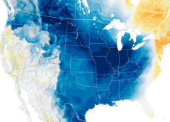
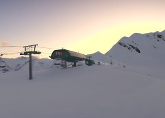
This event mercifully spared the majority Europe (given the energy woes there). Looking at the temperature anomalies for that time, we see a strong cold outbreak that was confined to the United States, particularly the West — a setup which no doubt contributed to those 19+ Western ski resorts posting their highest winter snowfall totals of all-time.
ENSO Phase (El Niño)
The ENSO phase can also increase the chances of a Polar Vortex disruption event occurring.
The graph below depicts the typical SSW event frequency by month and by the ENSO phase.
An El Niño setup, which we’re in now, has a higher chance of producing a Polar Vortex collapse event in the early parts of winter. Typically, major SSW events do occur during this period (Dec/early-Jan) — so that’s another box ticked.
Forecast
Looking ahead, the EMCWF stratospheric temperature anomaly forecast for 30 km (18.5 miles) suggests that we’re set for a warmer polar region, which hints at a potentially weaker Polar Vortex:
While impossible to forecast a SSW this far out, historical patterns, trends, emerging signals, and an overall global configuration point to a high probability that a collapsing stratospheric circulation and subsequent ‘Arctic Outbreak’ will hit this winter, spelling hardships and misery for mid-latitudes residents–particularly Europeans given the suicidal energy policies there.
We certainly have signals to keep an eye on, is all I’m saying.
More than that though–and for whatever it’s worth–this winter feels to me like it’s going be a cold, snowy and all-round testing one.
Bring it on.


This winter could be the one for central and southern Europe, real true winter has been lacking for many years in some places, I live in northern Italy, and the last harsh winter cold outbreak was in February 2018, just when last negative QBO occured…
Europe is focked. They allowed the US to bully them into cutting off the Cheap Russian energy, and now they will collapse.
WoW!! The Zonal Mean Temperature chart is very interesting!
Never seen that one before Cap! Thanks!
It set me to wondering if the weight of the 13% more water vapor in the atmosphere from Hunga Tonga in the Southern Hemisphere effected the overall pressure gradients creating a higher than normal pressure until it spread north and evened out around the globe.
Do we have now more overall atmospheric pressure due to that water weight???
I doubt anyone has checked before and after pressure.
Could it contribute to changes in consideration of altitude induced weather?
Dallas
I think you mean the zonal wind speed chart. I’ve never seen one before, or heard of the QBO, I’ll be looking for websites where I can keep an eye on these things.
I have a background in radar so I’m going to forecast a new phenomenon for the GSM just based on experience with primary and reflected radar beams. In the spring with snow on the ground, expect more of it during the minimum, when the sun begins moving from the south to the north, primary and reflected solar radiation will combine above the North Pole. Some solar energy will pass directly through the atmosphere, some will reflect off the snow. Does this combination contribute to the formation of SSW, increasing atmospheric heat and cause a change to the compact jet stream? Probability high in my opinion.
Time will tell but the convergence will happen sooner, more often and last longer as we descend into the GSM and snow falls further and more often into the more southern regions.
The larger the snow field the greater the SSW. That is the prediction.
So who would you consider to be a reliable source, Ronaldvop?
An old saying:
here’s nothing between the North Pole and Texas but a barbed wire fence.
ugh…There’s nothing…
I hate when I do that.
As in Minot, ND AFB, …… and polar bears
Gosh. There’s a spam my global boiling add taking over your site that makes Electroverse impossible to read. I suspect it’s deliberate as it refuses to move?
Use opera and a blocker.
Or use Brave
“More than that though–and for whatever it’s worth–this winter feels to me like it’s going be a cold, snowy and all-round testing one.”
The Old and New Farmers Almanac both agree with you and THAT is Historical! When THEY agree than Katy close the Windows Cuz Snow is a comin’!!!😁🥶🥶🥶🥶🥶😎🤣🤣
Hi Cap. It’s worth remembering that for reasons I don’t understand, and scientists may not fully understand, SSW and resulting major disruption of the polar vortex doesn’t always result in changes to wind patterns lower down in the troposphere and hence Arctic outbreaks.
Brave has been working for me very well.
In the last couple of months though ads have started showing up making my reading not pleasureble.
I found I could go to Settings, then Shields, then Block Scripts.
That gets rid of the ads. Then to comment like now I have to turn the
Scripts back on.
Dallas