Low Temperature Records Slain Across Midwest
Winter across the vast majority of the CONUS is refusing to let-up.
While a handful of cold records fell elsewhere–including San Francisco’s high of 52F (lowest for the day in books dating back to 1875, tied with 2006), North Carolina’s new monthly low (remarkable considering it’s late-March) and Naples’ 71F (tying 1995’s low)–most of the felled temperature benchmarks over the past 24-hours were confined to the Midwest, as visualized below:
Amid the new Midwest records was a low of -13F set in Bismark, North Dakota–which bested the old record of -7F set in 1964; and a low of -14F in Aberdeen, South Dakota–which comfortably usurped the previous record of -9F from 1969.
Snowfall records are also tumbling across the heartland, including the 2.2 inches reported at Fargo Hector IAP–which busts the old reading of 2 inches set way back in 1940.
More Snow Dumped Onto California Mountains
Hector airport’s totals pale in comparison to the epic dumpings continuing to pound the California mountains.
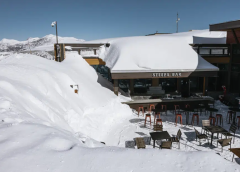
Mammoth declared its snowiest season ever after an additional 28 inches pushed totals to 695 inches (17.6 meters) at its main lodge and a jw-dropping 870 inches (22.1 meters) at the summit.
“It’s deep out there,” the resort wrote on its website.
The AGW Party declared California in a mega-never-ending-drought due to the ravages of CO2. However, trust in Mother Nature is a little lacking these days, we humans have apparently killed her, or at least ruined her ability to regulate and balance her climate, but this programming has been proven way off this season.
An unrelenting chain of powerful storms, which began in late December and are now persisting into spring, pushed statewide snowpack to its highest ever levels and saw the declaration of emergencies across dozens of counties; and in turn, the winter storms raised reservoir levels to historic levels — a significant source of California’s water.
As of Wednesday, March 29, the water content of the Sierra snowpack was 234% of the April 1 average — an all-time high.
This “unexpected” turnabout has allowed a rollback of many water-use restrictions, although Gov. Gavin Newsom has refused to declare the drought over. Such an admission would leave a lot of egg on AGW Party member faces.
The Cali drought was a poster child for man-made climate change, but as with previous milked-to-death scares, such as vanishing polar bears, melting Arctic/Greenland ice and bleaching of the Great Barrier Reef, the trend has been upended.
And so it also stands, Newsom, if California struggles for water later this year then we have only the state’s management of the resource to blame, not the climate, not carbon dioxide.
Ice And Snow To Extend Into April
The month of March has been an exceptionally cold and snowy month. And looking ahead, active patterns with abundant snows and historic lows are forecast to continue into April .
March in the town of Jackson, Wyoming–for example–will end up with temperatures roughly 10F below the long-term average, making the month reminiscent of a typical February.
This has also been a very cold and long-duration winter as a whole for Jackson. It hasn’t seen 50F since Nov 2, a streak of 147 days, which is approaching, and has a chance of besting, the longest streak on record — 163 days.
Coming up, additional heavy snow is forecast across the mid to higher elevations of the Tetons.
Even valleys should expect accumulations — rare for April.

Cold will accompany the snow, and will engulf a larger portion of the CONUS–and also Canada.
Winter is refusing to let-up.
Israel’s Cold Spring
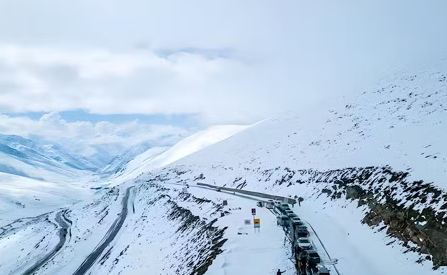
Spring may have arrived in Israel, but temperatures are still dropping and are bringing the chance of snow to Mt Hermon.
Below average temperatures will extend through the remainder of the week, according to the Israel Meteorological Service (IMS).
Record rainfall is also falling, even in the Beit Jamal area near Beit Shemesh.
Looking ahead, the IMS says there is a good chance of rare spring snow settling atop Mount Hermon–a mountain cluster constituting the southern end of the Anti-Lebanon mountain range, standing at 9,232 feet (2,814 m) above sea level.
Record Lows Sweep New Zealand
Cold has been the dominant weather feature in New Zealand of late, and additional record-breaking lows are on the cards, according to the MetService.
Meterologist Andrew James said a cold system had been moving up the country, driving Antarctic air further north.
“That has seen temperatures tumble right across the nation,” said James, “with the cold being felt as far north as the likes of Kaitaia, where it’s only 6C (42.8F) at the moment,” he said just after 6am.
Overnight temperatures in the City of Sails dropped to 5.3C (41.5F), the MetService said.
While across the likes of Alexandra, in Central Otago, and Wanaka, thermometers dipped below 0C (32F).
The coldest spot in the country was taken by Tekapo, which recorded an overnight low of -3.9C (25F).
Auckland is forecast to see its coldest night since March in 1965, when 6.6C (43.9F) was recorded in the city; and eyeing north, Kerikeri is expected to drop 6C, which would match its coldest March temperature since 1978, according to MetService data.
With regards to this coming winter, Niwa’s Ben Noll said the looming cold season will likely feel significantly chillier than the previous three, adding that this week’s record lows serve as a preview of things to come.
Noll points to the formation of an El Niño climate pattern which, traditionally, brings the opposite of La Niña.
This month, La Niña’s rare three-year reign is beginning to fade, and as New Zealand’s climate shifts toward El Niño, Noll believes the winter warmth its predecessor delivered will fade with it: Over the last couple of winters, we saw more of a northerly wind pattern,” said Noll, but moving forward, “The tendency may be for more southerly winds like we’re seeing this week.”
Still, there are other scientists, such as Professor David Dilley, that foresee a major change in how El Niño influences global weather patterns in conjunction with cooler North Pacific waters. For more on that, click the link below:


1875 is not far off the end of the Little Ice Age.
1875 is even closer to the Dalton Minimum period of roughly 1790 to 1830.
All the snow can be traced to find the origination, the layers can be tested separately per storm. Right now you can see the SO2 heading across the Pacific to the NW US and BC Canadian Coast arriving tonight from Kamchatka and Alaska volcanos on Windy.com just like most of the other storms for years. The model shows SO2 from Kamchatka breaks north again in a few days and heads into the Arctic like a fountain.
https://www.windy.com/-Show—add-more-layers/overlays?tcso2,2023040100,50.931,-153.809,4,i:pressure
https://www.windy.com/-Show—add-more-layers/overlays?rain,2023040100,50.931,-153.809,4,i:pressure,m:eYyacH1
https://www.windy.com/-Show—add-more-layers/overlays?snowAccu,next3d,50.931,-153.809,4,i:pressure,m:eYyacH1
There are smart people out testing the snow to find out what it’s made of but I don’t know any, it’s a small club and I’m not in it. It would be interesting to see some actual reports instead of hearing about another atmospheric river story as an explanation for it all but that’s probably never going to happen in this era of generalization and short attention span theater.
Nothing up to date on volcanic Sulphur dioxide plumes.
Correlation is difficult to establish without real time data.
https://so2.gsfc.nasa.gov/omps_2012_now.html
dit kan interessant zijn voor je?
https://www.volcanodiscovery.com/searchresults.html?cx=partner-pub-3740653521982427%3A9wc33x-8e80&cof=FORID%3A10&ie=UTF-8&q=SO&x=0&y=0
i mean this one, with CO2 as parameter
https://www.volcanodiscovery.com/searchresults.html?cx=partner-pub-3740653521982427%3A9wc33x-8e80&cof=FORID%3A10&ie=UTF-8&q=so2&x=0&y=0
Someone is posting your great finds in weather/climate news site .
The good news is that they even link to your site…
https://www.youtube.com/watch?v=4_601O1kfT0
Has anybody noticed that there isn’t any new “Keeling Curve” data from Mauna Kea, since they moved all the equipment from Mauna Loa? I guess, ahem, there must be something, um, broken like equipment or maybe “a dog ate my homework?”
I can explain the weather across the U.S.
First, what causes drought?
I learned the answer from my second or third grade teacher, back in the seventies.
Obstruction to air circulation causes drought.
It’s that simple.
When the environmental lapse rate is less than the adiabatic lapse rate the atmosphere is stable.
Atmospheric stability inhibits convection, condensation and precipitation.
When the environmental lapse rate is greater than the adiabatic lapse rate, the atmosphere is unstable.
Atmospheric instability allows convection, condensation and precipitation.
Extreme environmental lapse rates lead to severe storms.
Drought kills vegetation, leads to wildfires and accelerates erosion.
Erosion makes channels deeper and wider and hills steeper. Thinned vegetation and erosion provide more space for air to circulate and steeper updrafts.
Erosion works to eliminate the obstruction, because the heat is going to move, one way or another.
Conditions that result from drought will end drought over time.
Human interference can complicate the resolution.
For the past fifteen years, my neighbor has been tampering with the environment, to establish an inversion, to manipulate the local microclimate, in the Millet Swale watershed, at 6,000 feet elevation, southeast of Snowflake, Arizona.
An inversion entails atmospheric stability.
All of the washes and roads in the neighborhood that lead to Millet Swale have been compromised with obstructions, at both higher and lower ground.
Millet Swale drains to Silver Creek, which drains to Little Colorado River… Colorado River above Grand Canyon… to Lake Mead.
Just like a central air system, blocking a single vent in one room puts excess pressure on other vents, which compromises the efficiency of the entire cooling system.
Obstructing air circulation in Millet Swale compromised the entire Colorado River Basin.
The obstruction in the Colorado River Basin blocked air circulation from west of the Basin to east of the Basin.
See the U.S. Drought Monitor map for May of 2022 for the results.
Since 2012, I have worked to rehabilitate the watershed. The rehabilitation entailed increasing natural groundcover, thru simple activity.
Basically, I hiked every public easement, on both sides of the roads, to sow existing native seed, by giving it contact with the soil.
Vegetation cools the environment by using a bunch of incoming solar energy for photosynthesis and evapotranspiration and by shading the ground.
The cooler air sinks and lifts warmer surrounding air.
Since June of 2022, I have worked continuously to eliminate or neutralize debris and other obstructions from my 43 acres and other properties within the watershed (where I had legal access). Most of the mess was made by someone other than me or the result of the vandalism to my yard and the neighborhood.
The elimination and neutralization of debris minimized the collection of solar heating, which increases the temperature gradients with any natural or artificial heat sinks, which enhances convection and makes my yard cooler.
I’m near the top of the hill in the neighborhood, so making my yard cooler increases the environmental lapse rate.
My neighbor has done everything he can to heat up his yard and the neighborhood, so now my yard is lifting the artificial heat from his yard and from below.
The lapse rate is ridiculous.
The combination of the high lapse rate and conditions that resulted from the recent manmade droughts has led to some overshoot- record rainfall, snowfall and snowpacks in California, Utah and Arizona, tornados in the Southeast and even the Southwest.
Flagstaff hasn’t seen so much snow in a season for decades, and Arizona has seen a lot of flooding.
Since December 31 of 2022, I have had a weather station on my house.
Since January 1 of 2023, the weather station has recorded 3.9 inches of rain. That doesn’t include over 20 inches of snow that we’ve had. That amount of precipitation is higher than the average precipitation for Show Low, and Show Low is getting much more than average.
Another station that is less than ten miles to my north-northwest has recorded over 26 inches of rain since the beginning of the year, and that station doesn’t measure snow either.
Sanders, Arizona has recorded over 14 inches for the same period.
That’s some overshoot!
That is highly unusual for the region.
I am very nervous about what kind of weather there might be as the warmer seasons arrive. Monsoon, anyone?
In any case, the weather will continue to be very erratic until the tampering is stopped and the obstructions are eliminated.
I have been very busy cleaning up the messes. I hope you’ll understand if you have been ignored.
Hi Jack. Having had a weather station for three months means every day you will be breaking all time records. History awaits.