Russia Suffers Historic Lows And Snows
December across much of Russia has proven historically cold, with the east, in particular, seeing little letup.
Record temperatures have set in across the likes of Sakhalin, with the average high coming in some 10C below the norm.
In the Tymovsky and Smirnykhovsky districts –for example– lows of -33C (-27.4F) and -36C (-32.8F) have been logged, respectively. While the town of Okha, located in Okhinsky district, posted a record -31.9C (-25.4F) on Dec 26 which comfortably bested the previous low of -30C (-22F) set in 1946.
Frigid continental air will continue to flow into Sakhalin for the remainder of 2023, with more of the same forecast into January.
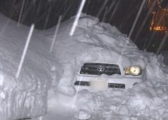
Looking west, the city of Yekaterinburg finds itself “buried under record snowdrifts,” as reported by gismeteo.ru.
Heavy snow on December 26 broke a daily record that had stood since the Russian Revolution of 1917. And by the morning of December 27 the city’s snow depth had reached 53 cm (21 inches) — such drifts (exceeding half a meter) hadn’t been seen for 25+ years.
“Life in the metropolis is paralyzed,” continues gismeteo.ru.
And there’s more to come.
Russia’s incredibly snowy start to winter will persist:

China Fells December ‘Cold Hours’ Record
On Christmas Eve, following weeks of record-setting cold and blizzard conditions across the county, China’s capital Beijing broke its record for hours of sub-zero temperatures in the month of December in books dating back to 1951.
To Sunday, December 24 a weather observatory in Beijing posted more than 300 hours of below-freezing temperatures since December 11 — the most for the month since records began in 1951, according to state-backed Beijing Daily.
Several cities in the central Chinese province of Henan, southwest of Beijing, are in the grip of a winter heating supply crunch, with thermal power suppliers in the city of Jiaozuo under pressure to ensure supplies.
For more on the crippling cold gripping Eastern Asia, click below:
Snow Strands Drivers In Scotland
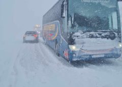
A major incident was declared after drivers became stranded for 8+ hours across miles of Scottish roads.
The A9 and other major routes in the north and east of the country were severely affected by blizzard conditions on Wednesday, December 26, with weather warnings still in place through Thursday.
This was the scene between the Falls of Bruar and Dalwhinnie yesterday morning:
Power cuts to some 27,000 properties have also been reported with workers struggling to reconnect.
Antarctica’s Unusually Frigid Summer Continues
Antarctica’s lingering summer is becoming increasingly noteworthy.
Regular readings of below -30C and -40C at Vostock have been posted, culminating in the -42.5C (-44.5F) on Dec 27 which came close to the all-time record during the second half of December: the -43.1C (-45.6F) set Dec 16, 2011.

Antarctic is cooling, the data are clear on that — discussed in more detail here:
Models Hint At Arctic Outbreak For U.S.
After a mild start to winter, a full-blown Arctic Outbreak now looms for North America with multiple models in agreement.
Here’s the GFS, which foresees anomalous polar cold descending the second week of Jan:

And here’s the CFS to back that up:

Which is also predicting a further intensification later in the month:

The run directly above is a long way out, but I’m not discounting it. The model is picking up on something — potentially some SSW…
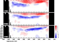
Next week, the stratosphere is predicted to serve up a Sudden Stratospheric Warming (SSW) event. Multiple forecasts are calling for a reversing of the stratospheric circulation from westerly to easterly, playing out during the first-half of January:
As well as the GEFS ensembles (above), the ECMWF is also seeing it, showing a major event:
SSW events often lead to a displacement of Arctic air southwards, often into North America and Europe. After their peak, SSWs can take a week or two to impact lower troposphere weather due to their effects having to filter down from the Stratosphere.
Long range outlooks for Europe are also picking on anomalous cold, akin to the US:

Adding further credence, the 30 hPa is already signalling the start of the event:
With NASA forecasting an intensification (for 90N) into Jan:
The agency’s 10 hPA foretells a similar story:
Stay tuned for updates.


Hi Cap,
If I understand correctly, a few articles will be free to view each month. Would you be able to place a banner on the pictures for those ones to indicate the can be read?
Sure, that sounds like a good idea Paul.
Looking back at the two previous GSM’s weather events, current weather events in Europe and China appear to be very similar. Will be interesting if China moves its Capital south to a milder climate location, which it has done in the past.
Excellent piece, Allan. Your ongoing contributions are always valued and appreciated.
Welcome back and thanks much, Cap
Excellent post. I find the information about the model runs particularly interesting.
Many in my Rural South Central KY area are seeing the same weather style as we did in 1978. That Blizzard shutdown numerous states with 18 – 30 inches of snow and 15 – 20+ ft drifts. I fully expect that and worse. Stick up and be safe all…
thanks Cap, much appreciated.
Thank you Cap.
We expect a cold start for 2024 here in Finland.
Check out the video in this link
https://www.is.fi/kotimaa/art-2000010087254.html
From about the 7th jan 2024, north Africa and parts of the middle east could see some snow at lower elevations, it could be brutal for those not prepared, The same In the U.S all the way down to mexico, miami, but that SSW might signal the end of winter? It wont last for long in Europe as Storm “Idiot” will roll in from the Atlantic after THE INCREDIBLE”Henk”…..peace on Earth 2024?
It may take me a little bit to learn to navigate the pivotal weather site, so thanks for posting the images, Cap.