Big Cool-Down Headed For Australia
In a classic seasonal ‘swing between extremes’, Aussies will be dealing with scorching spring temperatures one day, mountain snow and frosts the next.
Sydney experienced a relatively mild, although still hotter than average, Saturday with thermometers maxing out at around 26C (78.8F). Then a fierce 36C (96.8F) high is forecast to whip through on Sunday, followed by another toasty day Tuesday
“Sydney is unlikely to challenge monthly records, but that’s mainly because it will be early October by the time the heat arrives,” said Sky Weather meteorologist Rob Sharpe.
This year’s early onset of spring is in stark contrast to last year, when nowhere in Sydney logged a reading above 30C (86F) until the month of December — a reality long forgotten by the alarmists, it would appear; by their logic, global boiling began in Sept, 2023.
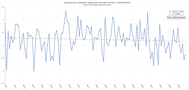
Also forgotten during this year’s burst of spring heat is the fact that the Aussie continent is cooling, undeniably so.
Over the past few years, I have document fallen cold record after fallen cold record, as well a telling drop in the average temperature which has formed a trend (of -0.132C per decade since 2013, as per the satellite data):
A return to this normal is forecast next week.
There will be a “clear reminder that it is still springtime,” so said Sharpe, when midweek temperatures crash back down below seasonal averages, and by some margin, too, and across the majority of Australia’s 7.7 million km² continent:

And in a double-inconvenience for the calamitists, “snow could fall in the alpine regions to [Sydney’s] south,” added Sharpe.

Snowfall Warnings In Place For New Zealand’s Desert Road
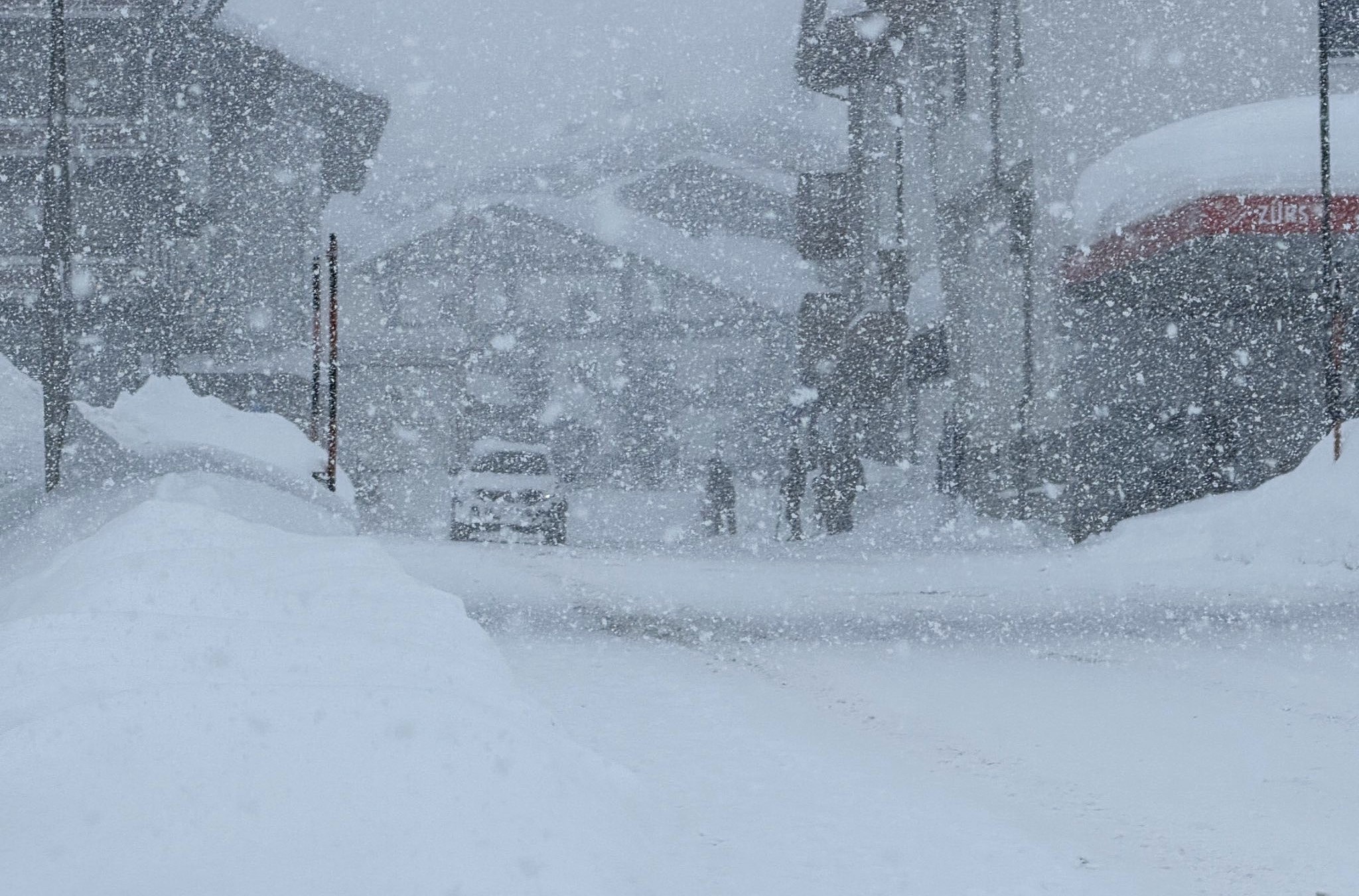
MetService has issued a road snowfall warning for the Desert Road, State Highway 1 as low-level as a late-season polar blast delivering anomalous lows and low-level snow arrive in New Zealand.
Snow is expected across stretches of the road late into the day, with flurries down to 800m (2,600ft).
MetService has also issued a separate Severe Weather Outlook which for the region from Monday, Oct 2 to Friday, Oct 6.
Elsewhere, the North Island–that is western, central and eastern parts–were all forecast heavy precipitation today, with snow spotted down to 600m (1,970ft), with flakes forecast to settle even lower later in the day.
While in Wellington, morning rain was the feature Saturday, with heavy snow hitting at 700m (2,300ft), perhaps a touch below.
The likes of Marlborough in the South Island also had a chance of hail and snow to 700m.
With locales such as Canterbury, Southland and Otago all witnessing accumulating spring flakes down to 400m (1,300ft).
Early-Season Snow Clips Mt Rainier
Western Washington residents have bid a definite farewell to summer.
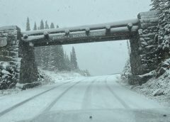
Mount Rainier National Park has been coated with plenty of snow, so reports the National Park Service on Facebook.
The Washington State Department of Traffic confirmed the regions flurries, posting pictures of snow-covered highways on X.
Local ski areas have not yet to confirm opening dates. Crystal Mountain, for example, has a projected opening date of Nov 22, although webcams show decent snow at higher elevations of the resort, so that date could be brought forward.
Campbell Basin is “looking nice and white,” posted @CrystalMt on X:
Winter 2023-24 is soon arriving, America — and potentially early, too:

Are these the beginnings of another record-smashing snow year, like we saw last winter when at least 20 resorts raised their bars for what a season can deliver.
Utah saw 9 of its ski resorts bust their all-time benchmarks during the 2022-23 winter; California at least 10; and Jackson Hole Mountain Resort in Wyoming brought the number to 20 (and these are the resorts I, personally, have been able to find and verify, there are likely more).
Further reading:


Waiting for the Blowering Blowhard (Adamin angler) palpitations to settle down and Im sure it will surface with some limp wristed comment or maybe still trying to decipher the big words over at Judith Currys blog.
He’s the kind of ‘person’ who refuse to look at stats/facts that are presented to him.
Soon he will say … wait for it…’Nuh uh’ and run away.
AND here in SC KY we have DOWNPOURS of 1″ + every few days and I am sick of it. Normally it would be dry. BUT if this turns into SNOW…I’ll be happy.
Refuse? I fully acknowledge your ‘stats’, but the only problem is that they’re flat out WRONG ! This September was the hottest ever recorded, and no, this is NOT a ‘cold’ system for October by any means. Snow above 1700/1800+m is NOT cold.
As you’re an Aussie are you going to comment on the decade long cooling trend which shows BoM claims of “hotter than ever” to be a pack of lies?
There is no cooling trend – satellite ‘data’ is simply invalid I’m afraid to tell you. Winter temps in particular have sharply warmed the last ten years.
P.S. I do not mindlessly believe what the Bureau tells me to believe – I look into the physical, measured data straight from the station myself, and I come to my own conclusions as to what those data actually show. And what do these data show? – a strong warming trend.
Cap,
Your Aussie temp graph is AWESOME!!!
Looking at the last 25 years, one sees the high highest ever almost, then the next low the lowest ever almost. This is the start of a right looking triangle when one draws a line slanting down across the peaks and slanting up across the lows. Then one sees a breakout DOWN!!!
This graphic analysis pattern is so valuable I plan to patent it.
Thursday using this pattern I made $17,000 in a single day of $22,500 of contracts.
It was very interesting. Transparency here, this was a Demo trading accoung. I start with real money Monday!!! My online Trading Instructor made $318k Friday using other methods which I use also.
Wish me luck. A course on How to get started trading online is in the making starting with only $500 for the course. The current course is for high rollers at a price of $20k. One Doctor with $3M learning it had to be cut back to $10,000 so he did not think he had too much to lose until he gained the necessary pattern recognition skill to be let loose with the higher amount for instance.
Better days are here now!!
Dallas
Yea, it’s awesome all right.-awesomely WRONG ! Imagine actually thinking that satellite data is somehow comparable to raw, measured data straight from the thermometer…I thought you denialists prefer the raw data ?!
Satellite data showed a rapid decline in Arctic sea ice extent up till 2008, bet you loved that data! Now satellites don’t show what you want them to you don’t think they’re accurate. This is beyond pathetic and childish, you’re only making yourself look even more stupid, if that’s possible.
Satellites are more accurate as they can take millions of readings a day covering the whole of the planet not just a few thousand mainly from airports and heat trapping urban areas. Sceptics prefer reliable data that hasn’t been adjusted by agenda pushing bodies such as the BoM, NOAA etc. it’s obvious what you prefer.
Ah, it has finally come in from the cold with all its usual clap trap.
What happened, did you bog the Nissan Patrol gas guzzler in the wet weather down at your fishing hole?
The graph looks like the temperature started below the trendline until 2016-7 then above the trendline until 2021 when it goes below the trendline and stays there until the present.
More ‘blue’ signs:
-Frosts are getting stronger in Yakutia
The area with subzero temperatures increases every day.
Now in the European part of Russia, in most areas of the Komi Republic, the temperature on the night of September 30 dropped to 0…-5°C.
In the Yamalo-Nenets and Khanty-Mansi Autonomous Okrugs, the air cooled to 0..-7°C. Even in the Middle Urals, in the Sverdlovsk region, frosts down to -5 ° C were observed.
In Siberia, a stable negative signal is observed in the extreme north (in Taimyr, Turukhansky region and Evenkia), as well as in the extreme south.
Temperatures in the Irkutsk region and Buryatia are falling to negative values, from 0 to 5°C. In the Trans-Baikal Territory, frosts intensify to -9°C.
But the most severe frosts chained Yakutia. There are already night frosts throughout the territory, but they are more severe in the Verkhoyansk region – up to -14°C, in the Oymyakon region – up to -18°C.
(Vostosnaja with -18.3°C – Ogimet Ranking)
https://www.hmn.ru/index.php?index=1&ts=230930112413
-It seems to me that the ‘season’ of catastrophic hot news will reduce or they will try to alarm us with ‘flaming’ 20°C…25°C.
My impression is we had a generally mild winter in Sydney this year, and an abnormally warm September. The last two weeks we had a few +30 days, so it felt rather summery.
Today was mid-30s, and a very welcome cool change this evening, what we call a southerly buster; typical summer’s day.
Given we had over a year with the temp failing to reach a piddling 32, I would expect a run of warmer weather this year. It’s the Law of Large Numbers in action and the nature of variation. After any run of below average numbers, one can expect a run of above average numbers that have a net convergence to a long term mean.
I guess we’ll see next week if I was too early packing away my winter wear and ugg boots.
It’s October now.
My big question to these retarded liberals:
What ever happened to all the huge hurricanes this August and September that were supposed to wipe cities off the map on the East coast this year and previous years hmmmmmm???
We have not had a major one on the East Coast in decades now.
I think it’s time for these liars to stop hiding under their blankets and tell us! This country is getting buried in snow every year due to a colder climate, but we’re not seeing those “cat 5” hurricanes. Where are they? Huh?????
For anybody who’s reading this: Make sure to vote as conservative as possible in 2024. Don’t listen to these liars on the other side and do not give them an inch – they are the CANCER of the USA. They are rattle snakes.
If you ever hear them by mistake, turn your volume OFF or switch the channel until they are gone – then turn it on again. Take those newspapers and throw them in the TRASH or burn them for starter paper this winter – you’ll need it. And smash your television!
Victoria, NSW and the ACT are in for some very interesting weather as a low pressure system moves in from the southern ocean, driven by the polar vortex over Antarctica, good rainfall and storms along with snow in the alps, will get a tiny amount of the system over South East Queensland, but it has been dry here so any rain is welcome, we were supposed to have a heatwave @ 35 degrees in Brisbane, two weeks back, big media whip up, and it was so mild, the weather system came through with a storm front and cold weather for three days, the seasons are about a month slow, at least with the trees, we have trees that flower every year around august, they only started last week, normally we would have two weeks of strong westerly winds during August, got them in Mid September, for a few days and not as strong.