Cool September For Argentina
September 2023 in Argentina was colder than the average, quite substantially so in the south, namely Patagonia:
Incredible snows have accompanied the anomalous lows, particularly across Patagonia.
Back in mid-September –and hot on the heels of receiving 3ft in just 24 hours, and before that, 10ft in 4 days– Argentina’s Las Leñas ski area received yet another fresh pounding of snow, with totals again exceeding 10 feet.
Many Las Leñas residents were left battling the snow, unable to leave their homes.
Similarly in neighboring Uruguay, September temperatures also averaged below/near normal (slightly above in the north):
South America’s chills have spilled over into October, too — certainly across the southern half of the continent.
Noteworthy lows in Argentina from yesterday (Oct 11) include: Maquinchao’s -9.4C (15.1F), Chapelco’s -6.4C (20.5F), Esquel’s -5.2C (22.6F) and Bariloche’s -4.3C (24.3F).
While looking ahead, the continent’s chills appear set to intensify as the month of October progresses, with the likes of Argentina, Uruguay, Bolivia, Paraguay and southern Brazil forecast temperature anomalies of as much as 20C below the seasonal norm:


According To NOAA Weather Station Data, The U.S. Has Cooled (2005-2023)
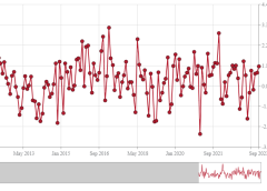
Official data show U.S. temperature anomalies (Jan. 2005 thru Sep. 2023) have cooled slightly, despite 44% higher CO2.
The dataset is created monthly by the National Oceanic and Atmospheric Administration (NOAA).
It uses state-of-the-art weather network consisting of 114 stations evenly spaced across the USA:

The U.S. Climate Reference Network (USCRN) uses properly sited stations, too, free from man-made influences, such as the Urban Heat Island (UHI) effect, as well as microsite effects–discussed in more detail here.
The graph (below) demonstrates what happens when you don’t mess with the data: the average surface temperature anomaly for the contiguous United States has barely budged in going on two-decades (since Jan 2005). It’s actually cooled, slightly.
Unsurprisingly, NOAA exclude this data from their monthly and yearly “state of the climate reports,” and so the public aren’t ever privy to the unalarming reality, to the raw, uninfected weather station data.
Pro-Skier Recaps Record Snow Year
Snow isn’t a thing of the past — the AGW Party was forced to tweak that vaticination somewhat. The IPCC once said: “milder winter temperatures will decrease heavy snowstorms”. That line has now vanished from recent reports.
Last season, as was the case with so many other resorts throughout North America (at least 20), Jackson Hole Mountain Resort, Wyoming had its snowiest winter ever recorded, comfortably besting the 577 inches set in 1997 (solar minimum of cycle 22).
Professional skier Owen Leeper hit the slopes all season, skiing powder “more days than I could count”.
Here’s Leeper’s 2022-2023 season edit (released Oct 11 on IG):
Last winter proved a record-smashing one for much of the North American continent, and this snow year is threatening to deliver something of a repeat, threatening to continue the multidecadal trend (Northern Hemisphere, 1967-2023):
Look out for the day’s second article, due to be released around 11:00 ET.
Further reading:


Sooner or later, the current false narrative (s) will crash and burn. Hopefully, so will the narrative pushers. No amount of TRUTH will penetrate the addeled brain cells of climate alarmists. They can be knee deep in snow, and still deny. By the way, did I not understand that the US just bought 2 icebreakers? I need to check that out.
Thanks, Cap for what you do.
Heavy snow in high alpine areas does NOT indicate cold ! In any way shape or form. All it indicates, is heavy moisture, which is higher than ever now due to an unprecedented warmth in our atmosphere – so of course we’re gonna get heavy snow in the mountains. You need only to look at lower-elevation, lower-latitude ski resorts (like those in Australia) to see that snow cover is at an all-time LOW ! Quoting an outdated IPCC report like your beloved Cap is doing, is highly disingenuous.
When will you denialists ever start reading REAL science and let go of these “snow = cold” delusions ??
AA, Why did you not mention the 13% increase in Water Vapor in Jan 2022?
Wouldn’t that increase the chances of snow?
Or is that event not in your library?
By the way the NH Snow Record since 2010 (Jan year of BIG 1,000,000 Fish Kill Freeze in Everglades with alligators noses breathing through iced over ponds frozen still and iguanas falling frozen from trees as they lost their grip) coincides perfectly with the solar minimum that year 2009 before now reversing direction in lock step with the current solar maximum.
Didn’t pick that one with the snow either did you A.A.?
Now locally here in SW Florida the big cooldown with the heavy rain fall front moved through 48 hours SOONER than Accuweather predicted last week. Not predicted til Saturday it was very blustery 24 hours ago raining 3 1/2 inches for the day. Just another rainy day in sunny Florida. We are ready for a cooldown though. It will be so nice!!!
Now the featured graphs shows peak temps declining AND low temps declining which is a clear trend towards a continued decline.
Stay warm folks,
Dallas
We get more than climate news on EV. I learned a new word: vaticinate, to foretell the future.
It is more than disappointing that NOAA excluded their own temperature data from their own climate report. Charlatans!
We get more than climate news on Electroverse. I learned a new word: vaticinate, to foretell the future.
It is beyond disappointing that NOAA does not include their own temperature data in their own climate report. Charlatans!
Sorry for the double post. The first post did not show, despite numerous re-startings of the page, until after the second attempt.