Exceptional Cold Strikes B.C.
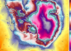
Exceptionally low temperatures swept British Columbia yesterday, June 20 — record levels for the time of year.
I’ve listed a handful of the felled benchmarks below:
Merritt’s 11.8C (53.2F); the 11.9C (53.4F) at Lillooet; Agassiz & Pemberton’s 12C (53.6F); the 12.2C (54F) at Lytton; the 12.6C (54.7F) at Pitt Meadows; Kamloops & Vancouver Harbour’s 12.8C (55F); the 13.3C (55.9F) at Hope; the 13.4C (56.1F) at Ashcroft; Vancouver YVR’s 13.8C (56.8F); and Kelowna’s 14.4C (57.9F).
South of the border, too, the June cold continues to prove historic in parts.
It may be the the first day of summer, but the mercury across California’s Sacramento Valley –for example– is feeling anything but summer-like. With highs in the 70s (F), the Valley continues to run some 15F cooler than average.
“This year, we are seeing something we really haven’t seen since 2011 where the March-April-May time period is noticeably cooler,” said state climatologist, Michael Anderson. This cold is helping many keep up after a historic snow year, continued Anderson: “[The cold] slows that pace of melt and keeps those peaks into that manageable space allowing those reservoir operators and downstream communities to coordinate their activities and really make the best use of the water.”
Sacramento’s stretch of cold temperatures is threatening to break records, with the city still yet to post a 100F day. And looking ahead, no triple digits are in sight for the next few weeks, meaning the city is expected break a long-standing benchmark.
“This could be a year where July is the first 100-degree temperature in the year, which that hasn’t happened since 1998,” Craig Shoemaker, a meteorologist with the National Weather Service (NWS) in Sacramento, confirmed.
Switching attention to Lake Tahoe, a 30-year-old low temperature record was felled here this week.
According to NWS data, Monday’s high of 54F at Lake Tahoe Airport was a full 20F below the seasonal norm, and broke 1995’s record for the lowest-high temperature. And then on Tuesday another record was toppled, again breaking a 1995 record for the date (1995: solar minimum of cycle 22).
Wednesday morning will bring sub-freezing temperatures to Lake Tahoe which will impact the region’s young shooting crops, as California –along with much of the Western United States– continue to hold exceptionally cool:

Heavy Summer Snow Hits Canada And U.S.
Heavy, record-breaking summer snow continues to accompany North America’s exceptional chill — a surprise burst of wintry weather that has silenced the ‘fire-and-brimstone’-peddling climate alarmists.
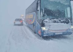
It’s June 21, but many ski resorts in western Canada have received multiple inches of snow.
Reported totals are topping 2 feet across the highest elevations of both British Columbia and Alberta.
Marmot Basin, for example –an under-the-radar ski resort located in Alberta– has received at least 8 inches of fresh snow:
Banff Sunshine Village and also Revelstoke Mountain Resort are two other locales to have witnessed anomalous late-June snow, as a stark, icy temperature drop swung large sections of the Okanagan from summer-warmth to winter-like-cold in mere days.
Similarly across Alberta, heavy wet snow has been accumulating over the higher elevations for days now, with more still to come.
As much as 61cm (24 inches) has already settled in some areas, such as Jasper — an incredibly rare feat for summer.
“Welcome to January,” tweeted Jasper National Park’s official account as the snow piled up.
And as with the cold, the snow isn’t restricted to north of the border.
Well over 6 inches has fallen on Tamarack Resort, Idaho, with a dusting reported at Beaver Creek Resort, Colorado.
While Mt. Bachelor, Oregon was forced to temporarily close its summer operations due to heavy late-season dumpings on its slopes.
Low Temperature Records Felled Across Australia
Australia’s east coast has been hit with a record-breaking cold wave, rendering the Bureau of Meteorology’s calls for a ‘hotter-than-average winter’ yet more agenda-driving claptrap.
Canberra’s low of -7.2C (19F) on Wednesday was its coldest June reading since 1986 (solar minimum of cycle 21).
Inland NSW also busted a myriad of June temperature records this morning, including Bathurst, which shivered through -7.5C (18.5F); Scone, which logged -5.1C (22.8F); Hillston, with its -4C (24.8F); Peak Hill’s -2.8C (27F); and Paterson’s -0.3C (31.5F).
Note, Scone’s -5.1C was the town’s coldest temperature ever recorded, for any month — tying the August 1991 record.
Similarly in Richmond, located northwest of Sydney, an all-time low temperature record was set here, too. The -6.2C (20.8F) endured Wednesday morning bested the locale’s previous record, set during the July of 2002, by a full degree Celsius.
The mercury plummeted to -1.6C (29.1F) in Campbelltown, located in Sydney’s southwest, making for its coldest morning –for any month– in years. It also dropped to just 1.9C (35.2F) in Hobart, 4.2C (39.6F) in Melbourne and 7.9C (46.2F) in Brisbane.
The BoM, unsurprisingly, is downplaying the cold, with Senior Meteorologist, Miriam Bradbury, already keenly pointing to a forecast warm-up due next week, which, she claims, will ring in warmer-than-average conditions for the rest of the winter.
However, this the tactic the BoM employed following autumn’s initial freeze. The agency is tasked with promoting the global warming narrative, regardless of real world observations. If it’s cold today, they point to warmth tomorrow, but never is today’s cold –record cold in this case– properly analysed or explained in the context of a supposedly catastrophically warming world. The cold is quickly swept under the rug, whereas heat is elaborated on and always attributed to man’s carbon dioxide excretions.
The data, however, point to a cooling Australia, whic has been the case for well-over a decade now.
Dr Liz Allen on Twitter has it right, writing “It’s cold af”:
X-Flare
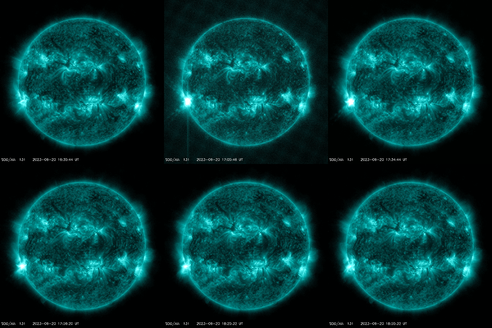
New sunspot AR3341 erupted on June 20, producing an X1.1-class solar flare.
NASA’s Solar Dynamics Observatory captured the extreme ultraviolet flash:
Radiation from the flare ionized the top of Earth’s atmosphere, which resulted in a deep shortwave radio blackout over North America, reports spaceweather.com.
SOHO coronagraphs have since detected a CME emerging from the blast site (shown below). It appears to be bright and fast. But, thankfully, up-to-date modelling by NOAA analysts reveals that Earth is not in the strike zone — though Venus and Mars are.
The strike on Venus (expected June 22) will probably erode a small amount of the planet’s upper atmosphere, while the strike on Mars (forecast for June 25) could spark spectacular auroras visible to MAVEN and other Mars-orbiting satellites.
Stay tuned for updates.


This article claims Europe is 2 degrees hotter than the average over the last 30 yrs.
I was wondering if you had any data to show otherwise?
I have the same problem in Australia where BOM use instantaneous electronic thermometers that record the hotter than mercury, place solar panels pointed at the thermometers to reflect more heat at them, claimed may will be 80% chance of being hotter than average only to end up with the coldest on record and again for June saying it would be bone dry only for Perth to have it’s wettest start on record
https://e360.yale.edu/digest/europe-fastest-warming-continent-climate-change
Frost on the shortest night of the year – RU
This year’s summer solstice fell on June 21st. And the shortest night too. From this day, the astronomical summer begins. But in Central European Russia, as well as in the northwest, the astronomical summer began with record low temperatures and frost. So, in Tambov, on June 20, a record minimum temperature was recorded, 4.8°C (earlier, in 2003, the air cooled to +7). Frosts were observed on the night of June 21 in the Murmansk region (down to -1 °C) and in Karelia (down to -2°C). The air cooled to -1 °C in Bashkortostan and the Orenburg region. There were frosts in the Central District: in Kostroma and in the north of the Yaroslavl region.
And on June 22, -2°C frosts are expected in the Kostroma, Yaroslavl and Ivanovo regions.
According to the results of the first two decades of June, a slight negative temperature anomaly remains.
https://www.hmn.ru/index.php?index=1&ts=230621113300
https://www.gismeteo.ru/news/weather/pogoda-v-moskve-astronomicheskoe-leto-nachalos-holodnoj-pogodoj/
—
New cold records on the Moscow surroundings.
The minimum air temperature in Klin was 4.5°C, which is 0.7 degrees below the previous absolute minimum of 1983 and 2007. Kolomna also has a new cold record, last night it was just 5°C, the The previous record with a temperature of 5.5°C remained in 1982. By the way, June 1982 and 1983 were cold, the average monthly air temperature was -2.8°C and -3.5 degrees below normal, respectively.
https://www.hmn.ru/index.php?index=1&ts=230621085016
—
Things aren’t going well, they can’t change the climate, now they can get rid of all the anti-CO2 garbage and throw themselves themselves into the fire!
Hello Cap,
I don’t know if the web page of yours has an issue or not, but on my end, the first videos or pictures on this article don’t show up.
Example: EXCEPTIONAL COLD STRIKES B.C. There is a video and its just appears like a grey box with the processing circle (spooling symbol).
No jokes and no criticisms, just saying.
I appreciate your work and have taken it into account for a long time. Thank you for spreading the news of what is happening.
Best wishes,
David
Happy Greta Day all! We’re still here.
Ha.
I hear (she) is after the windmills and oil tankers now..
Stay focused Greta!
Cap what about these CME’s shown on the Coronal Mass Ejection video? I count three LARGE CME’s…
https://www.swpc.noaa.gov/