Verkhoyansk, Russia Records Earliest -10C Since 2008
The northern federal subjects of Russia have been holding anomalously-cold of late.
Across northern Siberia, in particular, ‘blues’ have been the dominant feature which has delivered an early onset of Fall.
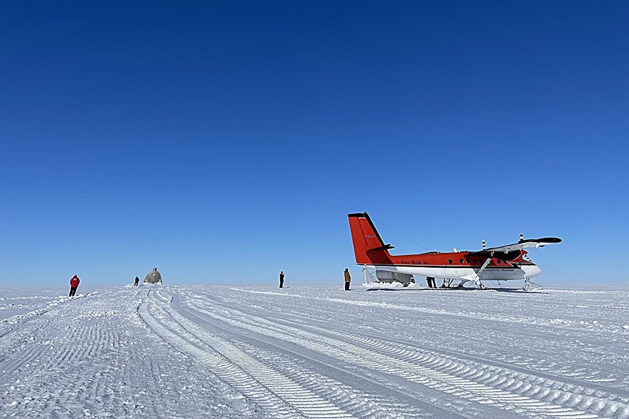
The infamous northern Russian town of Verkhoyansk posted a low of -10.1C (13.8F) late last week, the locale’s earliest -10C since September 17, 2008 (solar minimum of cycle 24).
Verkhoyansk’s infamy is tied to the events of July of 2020: “The Arctic Is On Fire, and We Should all Be Terrified”, when the media pushed a summer heatwave as evidence of the ‘climate crisis’, only for it to start snowing a few days later (story archived here).
Back then, temperatures plunged from balmy summer highs to sub-zero lows (C) which prompted Verkhoyansk locals to release a video of themselves warmly dressed and huddled around a fire asking “where is our plus 38C?”.
This week’s cold hasn’t just been confined to the northern Asia, either — southern and eastern parts have also been shivering.
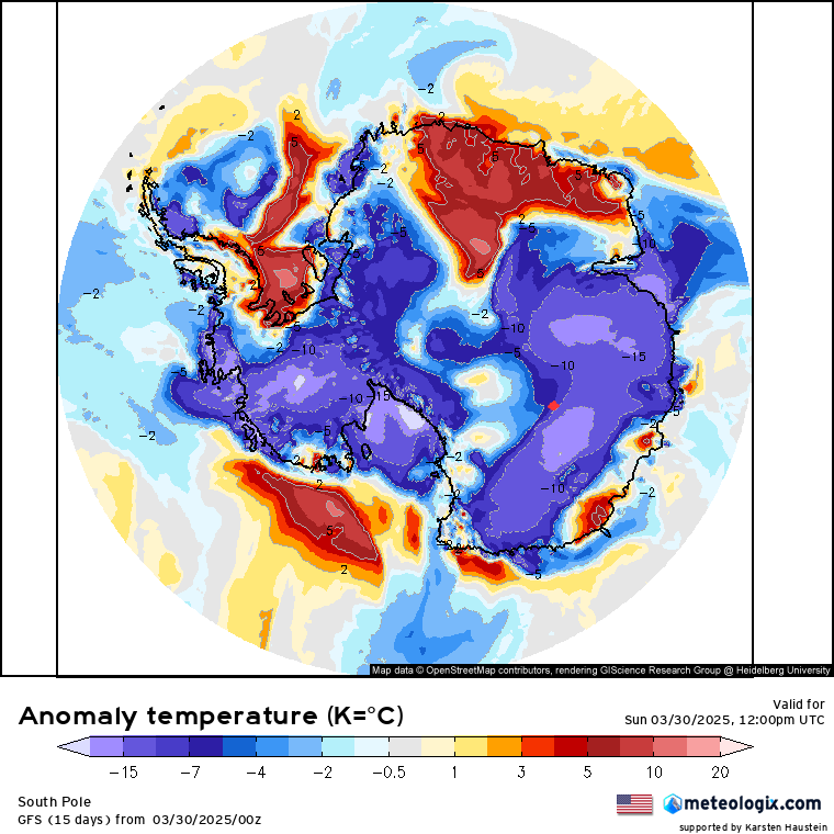
The temperature anomalies yesterday (Sept 25) were really quite stark, with readings as much as -14C below the seasonal norm sweeping the likes of western Mongolia, northern/eastern China, and also the Middle East and India:

Snow Returns To Kashmir
India has indeed been shivering. Temperatures have been low enough to see snow clip the higher reaches of Kashmir.
Snowfall has settled across the northern mountains, including at the holy cave shrine of Amarnath and also Gulmarg.
The flakes ended what had been a prolonged dry and warm spell.
Looking ahead, much of India is forecast to hold colder-than-normal:


A recent IITM study found that extreme ‘cold waves’ are increasing across India “despite global warming”.
The analysis, led by Indian Institute of Tropical Meteorology (IITM) scientists Raju Mandal and Susmitha Joseph, took into account the number of cold wave events over the past seven decades (1951-2022) and discovered that more cold wave days are occurring in recent decades than in previous ones.
India declares a ‘cold wave’ when the temperature reaches 10C (50F) or lower, or is 4.5C below a locale’s average.
“In the recent decade, more cold wave days have been observed across the central and eastern parts,” said Mandal, “In Madhya Pradesh, Jharkhand, Vidarbha, Marathwada, Uttar Pradesh, Bihar and also some areas of northwest India such as Chhattisgarh, Haryana, Chandigarh and Delhi.”
According to the research, central and eastern India has seen the average number of cold waves increase by more than five days per decade, and by more than 15 days per decade in some places.
On average, these regions used to record 2 to 5 cold wave days per 10 years during most decades from 1951-2011, but this rose to nearly 5 to 15 days in the last decade (ending 2021).
Even in built-up areas, where the urban heat island (UHI) effect will be a factor, the data showed that cold waves days in Haryana, Chandigarh and Delhi have increased to 5 to 10 per decade during the last 20-year period versus the average of 2 to 5 in the previous decades.
Mandal said: “We wanted to understand through the study if there can be a reduction in cold wave events amidst a global warming scenario. We, however, found that occurrences of cold wave events have continued even under the general warming scenarios.”
Another Polar Blast To Bring Low-Level Snow To New Zealand
Following last week’s atmospheric river that buried the higher elevations of New Zealand in spring snow, this weekend is threatening to deliver an even fiercer blast, with “rough and ragged” weather forecast to bring snow to “low levels”.
A cold and stormy Southern Ocean will whip a powerful Antarctic air mass over all of New Zealand in the coming days:
Niwa meteorologist Ben Noll said the front would be pushed up by a “resurgence” of the polar jet stream.
“The polar jet starts to develop this week in the Australian Bight south of Tasmania, and then a piece of that moves right into New Zealand, and across the country, on Saturday,” elaborated Noll.
“As that southerly moves up, it looks like there could be a relatively strong low that forms along it near the North Island, and this is going to come with some pretty rough and ragged weather conditions for much of the country.”
That is, low temperatures and low snow elevations in the south — “this could be a significant event, potentially,” warned Noll.


Niwa –an AGW Party member through and through– had promised Kiwis a fiery spring heatwave, a forecast that is now being mocked by many on social media.
“Where is this hot weather you told us about?”, asked one comment on X.
“A promised heat wave that never materialised. Is Niwa joking with us?”, read another.
Niwa is due to issue its outlook for the final three months of 2023 later this week. However, some frantic re-tuning might be in order given this looming and surprisingly strong polar air mass. The agency may even delay its release so folk aren’t reading “hot spring expected due to global boiling” spiel as the unseasonal snow piles up outside their windows.


Alaska volcano Shishaldin blasts to 45k last night on Diamond’s report. Plume here already, heavy rain forecast:
https://www.youtube.com/watch?v=7Hy99qpsST4
https://www.windy.com/-Show—add-more-layers/overlays?tcso2,53.120,-129.111,4,i:pressure,m:fcnaB6
https://www.windy.com/-Show—add-more-layers/overlays?rain,2023092715,48.247,-123.508,7,i:pressure,m:eYhacJc
There is a paper by the solar physicist, Valentina Zharkova, who discovered how two magnetic dynamos at different depths in the Sun give the 11-year sunspot cycle and another cycle of around 400 years. She says that the Sun is going to be cooling enough to lead to a mini-ice age for around 40 years with probable crop failures starting in a few years.
‘Modern Grand Solar Minimum will lead to terrestrial cooling’
https://www.ncbi.nlm.nih.gov/pmc/articles/PMC7575229/
NOAA also agrees that the sunspot number will be reducing starting in 2025 and going to zero in around a decade and that will reflect a lower solar output leading to terrestrial cooling.
https://www.swpc.noaa.gov/products/predicted-sunspot-number-and-radio-flux
The geological climate of the Earth as a whole is still a 2.58-million-year ice age named the Quaternary Glaciation. That fact is seldom mentioned in “Climate Change” stories and reports.
The Earth is in a warm interglacial period that happens about every 100,000 years and lasts about 10,000 years which alternates with a cold glacial period that lasts about 90,000 years. The Earth still has around 200,000 glaciers and 11 percent of the land is permafrost.
The ice age the Earth is in won’t end and the geological climate won’t officially change until all the natural ice melts. https://en.wikipedia.org/wiki/Quaternary_glaciation
The so-called ‘Climate Scientists” have had the word climate redefined so that now climate only refers to a 30-year periods. With that redefinition “Climate Change” is always happening.
A US Winter Weather Forecast For 2023-2024 Says America Is In For A Stormy ‘Comeback’ Season
Get your shovels ready! A U.S. weather forecast says the country is in for a traditional season with some blizzard conditions and plenty of snow.
https://www.msn.com/en-ca/weather/topstories/a-us-winter-weather-forecast-for-2023-2024-says-america-is-in-for-a-stormy-comeback-season/ar-AA1gCiWt
Hey Cap, Electroverse is being maliciously overtaken by global warming spam from humix. The intrusive “ad” situates itself onto your page and will not go away— indeed it seems to have no mechanism to do so. I can get rid of it with Adblock, but then you lose all your ad revenue . Hope this can be fixed. Basically it makes your site unreadable and I suspect that’s the intention.
Hi Elliot.
This is a frustration.
Could you please provide a screenshot of the ad, so I can send it to my ad network and ask what can be done about it.
I have recently (Sept 26) ‘toned down’ the advertising, hopefully this will have some effect.
Best,
Cap