“Surprise” Late-Season Snow Hits Reykjavík
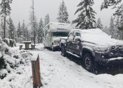
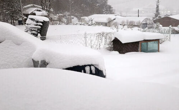
Resident’s of Iceland’s capital woke to a blanket of snow late last week.
Officially, 4 inches settled in the city area — a rare occurrence, according to Icelandic Met Office meteorologist Teitur Arason: “In the last 75 years, there have only been 4 instances of this much snow falling in the Reykjavík area in the second half of April.”
A low-pressure system was responsible for the unseasonable snowfall, continues Arason, snow that has since pushed to the south of the island where authorities have been urging southerners to check conditions before venturing out.
Behind the snow have been bitingly cold temperatures with thermometers even dipping below the freezing mark.
Frosty Queensland
Australia’s pre-winter cooling is forecast to persist this week, further demonstrating the ‘probe-loving‘ BoM’s calls for a ‘warmer-than-average’ autumn nothing but an agenda-driving fantasy.
Sunday morning delivered anomalously-cold temperatures across the entire continent — a familiar scene:

Bureau of Meteorology forecaster Harry Clark said a low-pressure trough is sweeping Queensland, bringing cooler air to much of the state: “The minimum for Stanthorpe is forecast around 5C (41F) on Monday and Tuesday,” he said, adding that maximum temperatures, particularly for inland areas, would be up to 10C below the multidecadal average.
Roger Stone of the WMO is quick to blame Australia early cooldown on natural factors, namely the developing El Niño: “We tend to get early cold blasts that can come from the south, that’s pretty typical during El Niño years — clear skies and plenty of frost, once we get into winter … We tend to have an early start to winter and a late finish, so it’s a bit of a double whammy effect.”
This sounds like the establishment getting its excuses in early.
But what about the documented and stark cooling of the past few years, during the rare triple-dip La Niña? These factors, despite mainstream protestations, were a complete surprise to mainstream ‘Climate Scientists’, factors that should have shook the very foundations of the CO2-induced anthropogenic global warming theory–if the theory wasn’t so protected and dogmatic, that is.
Historic May Cold And Snow On Course For Michigan
The forecast for the start of May looks COLD across the likes of the Upper Peninsula — record cold, with heavy snowfall.
Checking the books, the last measurable May snow to hit West Michigan was in 1994 (approaching solar minimum of cycle 22).
Monday is also forecast to see a high of 42F, which would make it the coldest May day since at least 1976 (solar min of cycle 20).
Back to the snow, an ‘Omega block’ is expected to deliver a record-breaking May snow event across Michigan’s Upper Peninsula on Monday, according to the latest forecast by Fox Weather, bringing with it “extremely dangerous conditions”.
The Weather Prediction Center’s Winter Storm Severity Index (WSSI) is calling for “substantial disruptions to daily life … extremely dangerous to impossible driving conditions and extensive … and widespread closures and disruptions to infrastructure.”
Despite 40+ years of ‘catastrophic global warming’, WSSI is a recently developed multi-million dollar tool meant to aid decision-making when snow, ice and freezing lows loom. Think of the Storm Prediction Center’s categorical outlook for thunderstorms, but instead of warning about hail, wind and tornadoes, the WPC’s new product warns of the impacts of winter weather.
The WSSI has been triggered this week and is warning that record-breaking snow–rivaling the 2 feet that hit during the infamous May 1990 storm–is about to pound Michigan’s Upper Peninsula. At least 2 feet is forecast for L’Anse, Michigan, with widespread snow totals of a foot expected elsewhere along Michigan’s Upper Peninsula.
Winter weather alerts have been issued across the region, where felled trees and downed power lines are expected to result in power outages; while from Ironwood to Marquette, Winter Storm Warnings are in effect — in May.


May’s return to winter isn’t confined to the Upper Midwest/Northeast.
For one, anomalous cold is sinking south, all the way down to Florida…

…but a biting freeze is also engulfing north of the border, too, into Canada, where the likes of southern Ontario, for example, are also threatening to break historical benchmarks for both lows and snows.
Heavy Spring Dumpings Continue Across European Alps
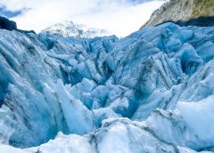
European glaciers have been dumped on in recent weeks, dispelling MSM ‘snowless winter’ notions as nothing but gun-jumping garbage.
But remember, “Glaciers are the ambassadors of the climate crisis,” so says Matthias Huss, of the Glamos glacier measuring network — just like Arctic sea ice used to be, and like the Greenland ice sheet used to be, and like polar bear numbers used to be, and like the Great Barrier Reef used to be, right Huss?
Even this season’s historic, all-time record-breaking snow ACROSS the Western U.S. can’t be used to dispel ‘climate crisis’ dogma. We’re told humans are adding energy to the climate system, but we see this action playing out very differently depending on where you look. For example, the U.S. has been buried under unprecedented volumes of snow/ice this year, while the Alps–which make up a far smaller area than even just the Rockies alone–has witnessed less snow than average.
Tasked with tracking the amount of snow on some 20 Swiss glaciers, Glamos has just evaluated the latest data.
Despite the lack of snow at the beginning of winter, which the network believed would see the 2022-23 season rewrite European record-books, heavy and persistent snow since Easter has seen the deficits reduce, and by large margins.
In fact, western Swiss glaciers are now tracking above normal, as are many mountains across Italy, Austria and France.
Moreover, these high altitudes are forecast yet more snow in the coming days and weeks, even as the calendar extends into May, adding to the exceptional dumpings of late-April–which also weren’t included in Glamos’ latest analysis.
Man-made greenhouse gases are responsible for climate change, assert ‘experts’ such as glaciologist Andreas Bauder, who then goes on to say that “several snowy and cool years would be necessary to make up for the Alp’s lack of snow.”
But this is hardly a tall ask and shows we’re nowhere near that ‘point of no return’ purportedly passed many moons ago now. Just look, again, to what’s occurred across the pond: a ‘1,200-year CO2-induced mega-drought’ was undone in just a few months.
How much longer can they peddle this poverty-inducing claptrap?
Until we’re all dead poor, I assume.


Does anyone know why DMI has not updated Arctic Ice Extent since 22/4/23?
After a 1.6 inch rain yesterday very early morning, lots of thunder and lightning,
https://youtu.be/L5nT6Eg_Mz0 “Florida Tropical Sunday Morning”
this Monday morning started cool with a 19 F Sky temp, 60 F on the Glass table exposed and 64 F Air temp on the patio swing set not exposed to the sky.
Dallas
See my one day offer of 10X your money this month.
https://twitter.com/SchneiderDallas/status/1652711759050842114
I am working on a few offers of the entire $600k USD needed but I will honor any smaller amounts sent me also. One considering it is a billionaire who makes $8M/annually paying a $4.7 M/monthly mortgage who would like help getting out of that payment! Let’s see what happens.
I have tried to find out how the Harding ice field, a 400 mile long sheet of ice in Alaska feeding several glaciers, is fairing but so far no luck. I suspect the info is buried somewhere deep as it will be inconvenient for the global warmests.
What explanation (s) would your analysis give to the persistent draught in Spain, Cap?
Even when the models give lots of rain, even when the predictions are within the 24 hour range or less.
Even when it is extremely cloudy.
What could be the impact of other factors of the troposphere such as the loss of autoctone forest (trees typically releasing lots of humidity and terpenes), the substitution of massive extension of lands then to eucaliptus trees or massive windmills and solar panel extensions. The burning of Portugal some years ago, followed up by Galicia, now Asturias, and some decadea ago Andalucia. What is the impact in the mid and long term? If we take the biotic pump system of naturalized forests creating clouds and continental rain…into the mix? How do all systems intercommunicate? All layers of atmosphere? We don’t know yet.
It was snowing here this morning. I live in Pennsyltucky. It’s 42 degrees F right now at 2:00PM and it’s …..May.
Hard to believe.
Here in rural KY we had a hail storm yesterday and hail covered the ground. Temp was 44°F but felt like 38°F.
And we just planted 12 tomato plants – Rutgers. Luckily they are fine.
But this planting is a month behind for our area. May have to build a greenhouse…
UP of MI here. Love the site Cap, check it regularly for reality.
Several power outages at our home due to heavy, wet snow. Schools, the university, many retail stores and some banks closed.
Daughter lives in the ‘bowl’ by weather station outside of Marquette, hired front end loader to clear their drive, even he got stuck.
Greenland has eight feet of snow forecast in the next ten days. Alaska has ten feet forecast in the next ten days, the most on the planet. Greenland reading -28F right now and down south of OZ it’s a balmy -85F. Ice building down south and still lots up north is the definition of what?
https://www.windy.com/-Show—add-more-layers/overlays?snowAccu,next10d,59.790,-145.063,5,i:pressure,m:fk7aZh
https://www.windy.com/-Show—add-more-layers/overlays?temp,-70.110,110.566,3,i:pressure,m:ulaiJh
As we have entered a grand solar minimum the rest of this century will be, in the main, Cold and lots of rain snow hail and frosts. Ironically this will be interspersed with heat waves, and I mean real ones, not the manufactured ones.
Confirming for coastal central Queensland, Australia
– far colder minimum temps (12 deg C) for the past few nights than long term April- May average of 18deg C. And forecast for next week is more of the same cold nights.
Tuesday SW Florida cooler than Monday Morning –
Sky 16 F Ground 58 Air 66 hmmmmmmm
Air temp is up 2 F, may have been effected by heat from AC
as we did run it all night even though it’s 40 feet away around the corner!
DS